Mappa Rea

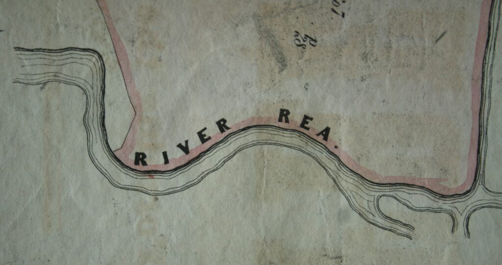
The Rea is a well-known companion to Stirchley, flowing gently to the east, tucked away in the parks and behind houses.

A couple of the volunteers have been ordering and cataloguing some of the photographs of the Rea which are kept in the library (see some of them here). As part of this we started to work out where some of the more local ones had been taken and drew a rough map….. which has now become a slightly less rough map.

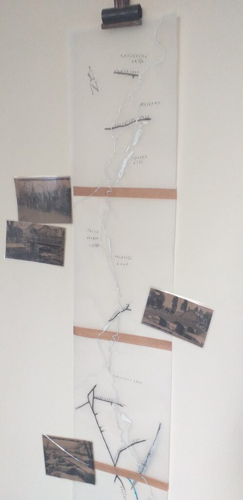
Using Ordinance Survey maps from the 1880s and 1890s, we traced the meandering Rea and some of …

Continue Reading →

Lifford Mill & Lifford Hall

Lifford Hall, 1969, taken by Phyllis Nicklin.

It is uncertain how old the place name of Lifford is. It is thought that the Roman Road Icknield Street crossed the River Rea here, and a ford is a river crossing point. The name Lifford, though, cannot be found in reference to this area before the arrival of Viscount Lifford who bought, what is now Lifford Hall, in 1781. The first record of the area being called Lifford is in 1785, when “Thomas Dobbs of Lifford” was noted at “Lifford Rolling Mill”, but this seems an incredibly short space of time …

Continue Reading →

Lost Brooks of the Rea Nᵒ. 1

The Hazel Well (as explored in a previous post, here) was possibly a natural spring rising in Stirchley, where Hazelwell Park is now. Along the route of the River Rea through Stirchley and nearby, there are several brooks. Some are well-known, such as two confusingly named Bourn Brook and the Bourn. These are longer brooks which still survive today. The Bourn Brook meets the Rea near Cannon Hill Park, and the Bourn joins it a little north of Cartland Road.

There were other lesser known brooks, such as Cotteridge Brook and Breedon Brook, the latter seemingly now gone from …

Continue Reading →

Pershore Road Past

1602 Pershore Road.

The section of the Pershore Road which stretches from Breedon Cross to Bournville Lane is very likely the “streete” which gave “Stretley Streete” (the old name for Stirchley) its name (see here). We were recently lent some family photographs of two of the houses on the street by Pam Hobson, a member of Stirchley History Group.

I wonder how many of the original doors, stained glass and decorated lintels (above the windows) can be found along the street? And other traces of the past lives of the buildings?

If you have any photographs of Pershore …

Continue Reading →

Traces of the Hazel Well and Hazelwell Mill

Hazelwell Mill was situated along the River Rea, near Hazelwell Park today. The photograph above is from Stirchley Library’s collection, and although undated was probably taken in about the 1930s. At this point, the mill buildings had expanded. The pool at the front is the millpool (like at the surviving Sarehole Mill), which was used to build up the flow of water and would then be let onto the waterwheel(s) when needed.

The area of Hazelwell was, from at least the 1300s but probably well before, owned by the Hazelwell family. Their name was probably taken from the area rather …

Continue Reading →