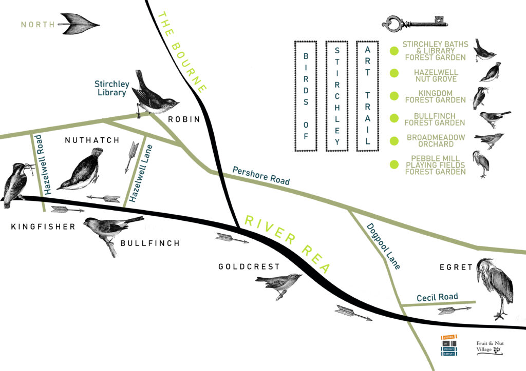
During Birmingham Heritage Week at the beginning of September, we organised a heritage walk along the River Rea. This followed six bird portraits by local artist Stephen Earl Rogers positioned in community gardens run by Fruit & Nut Village, and a talk on route about the history of the Rea in Stirchley by Jen Dixon.
This guide provides an outline of the walk so you can go hunting for the six birds yourself, with the aid of the map (above).
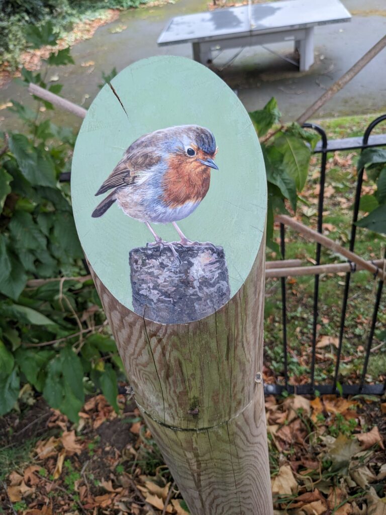
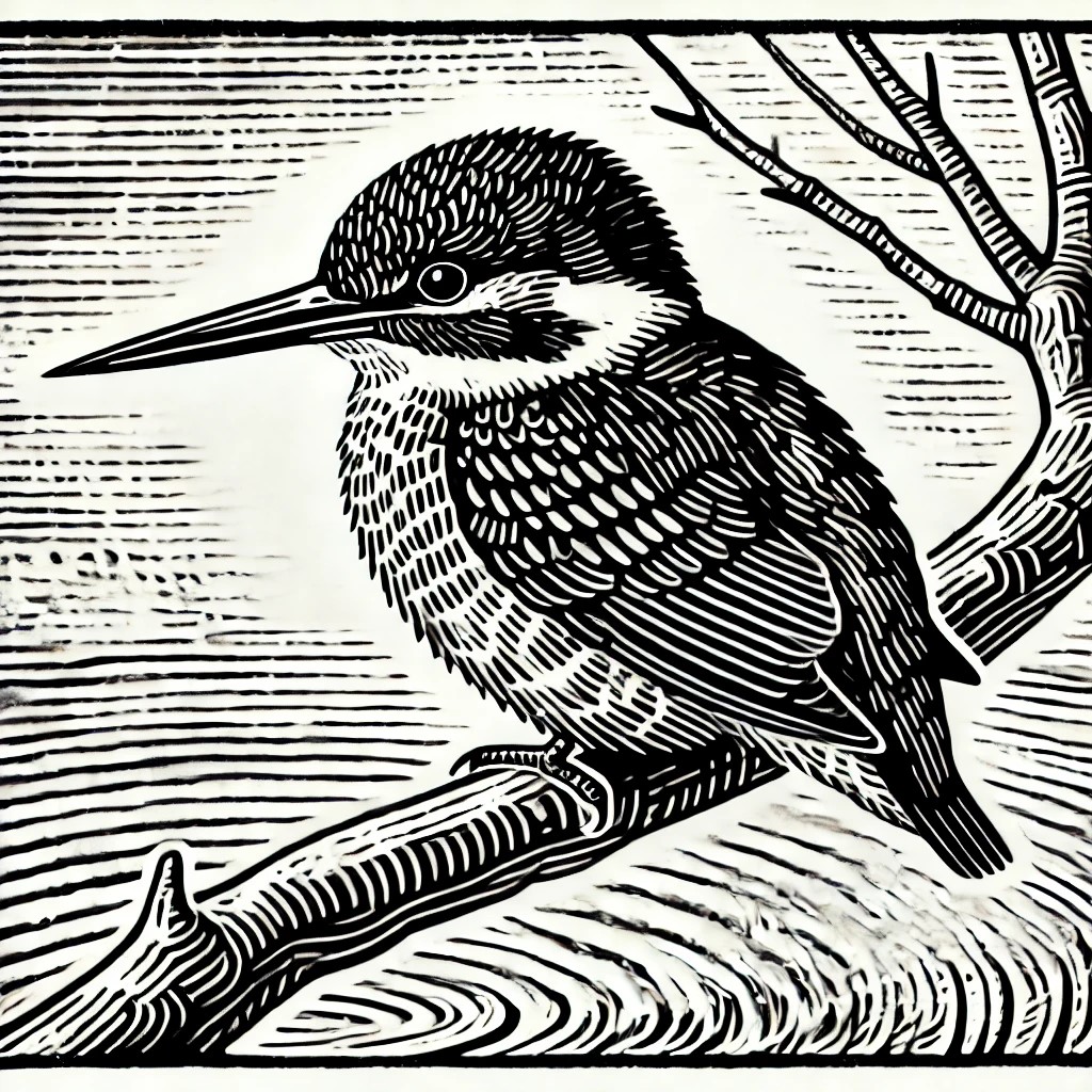
The walk began in the Forest Garden at the rear of Stirchley Library and Stirchley Baths. Here is the robin. It can be accessed safely through Stirchley Park.
Historically, Stirchley was a small settlement in the parish of Kings Norton. It’s old name (with multiple spellings) was Strutley Streete, meaning the clearing (ley) by the street (strut). So, the clearing-by-the-street-street. Why the street was mentioned twice in uncertain, but it was, almost certainly, a very important street that was being noted. The section of the Pershore Road which drive in a straight line through Stirchley is generally considered to be a stretch of the Roman road Icknield or Ryknield Street.
The “ley” part of the name, meaning clearing, highlights how densely wooded the area was, too, with Norton Wood to the east and the Forest of Arden on the other side of the Roman road to the west (see maps, here).
The first known mention of Strutley Street is in 1658, in a document which also mentions Stretley Brook. Was this the name of the Rea in Stirchley? There are other contenders. The Bourne was at the north end of Stirchley forming a border with the parish of Northfield, but this was referred to as the Barnbrook in other documents from the same time. There were two small brooks whose waters rose in Stirchley, but these seem to small. The other contender is Cotteridge Brook, which now predominantly flows underground but appears briefly on the other side of the road to the Wickes hardware store.
Next it is time to move on and go looking for the nuthatch painting. We will need to cross that old Roman route and meander down Hazelwell Lane to the Rea banks.
We arrive at the Hazelwell Nut Grove, full of varieties of nut trees. It is not surprising that the nuthatch was chosen for this garden.
The Forest of Arden was an ancient stretch of woodland which stretched across Warwickshire and parts of Shropshire, Worcestershire and Staffordshire. It was bounded by four Roman roads, with none cutting through the forest. Icknield Street formed its eastern border.
The forest can be remembered locally in place names such as Henley-in-Arden, Hampton-in-Arden and Tanworth (you guessed it)-in Arden. Mary Arden, William Shakespeare’s mother, had a geographical surname relating to the area, and his As You Like It was set in the Forest of Arden. Moseley Bog is now a nature reserve, but is one of the few surviving remnants of the forest, and inspired the Old Forest in the Lord of the Rings books.
The land was poor agricultural land, meaning it was left be by the Romans and many subsequent settlers, leading some to speculate that the accents from the Midlands are closest to the old English Midland dialects.
We continue walking south down the western bank of the river, in the direction of Lifford, crossing Hazelwell Road.
The kingfisher resides at Kingdom Forest Garden, a large orchard and wildlife haven.
Here we can imagine where the Rea might take us if we followed upstream to its source (we won’t). If we take the public footpath the river flows, inconveniently, under the railway bridge and we lose it. But we find it again by Lifford Reservoir (a canal reservoir formed to support the Rea mills which lost water to the canals), in Kings Norton Park, at Wychall Reservoir (another canal one), through Northfield, Longbridge and Rubery, and then on to its source in the Waseley Hills, where the water can be seen bubbling up from the ground.
At Lifford, was the first of Stirchley’s three main water-powered mills. It was an old mill, so originally a corn mill grinding grain for bread. As industry edged into Stirchley, it became a rolling mill, so was used to roll metal flat. Local myths stated that secret tunnels stretched underground from the mill and the nearby Lifford Hall, built in 1604 in top of a much older structure, all the way to Kings Norton Church. On excavation of these, though, it was found that they were mill leets, supplying water from the river to the mill.
To find the next bird, we turn back on ourselves, and recross Hazelwell Road but take the path on the other side of the river, along the edge of the industrial estate.

The bullfinch at Hazelwell Fordrough is found just before you reach Hazelwell Park. It is a small forest garden.
Once we reach this point we have already passed the old site of Hazelwell Mill, and the secret millstone hidden in the bushes. Like Lifford Mill this was a corn mill, but converted into a mill for grinding gun barrels by 1800. Stirchley had a large trade in guns and gun barrels, and has one surviving business – Jesse Hill’s opposite Wickes on the Pershore Road.
The name Hazelwell suggests that there was once a natural spring near here called the Hazel Well. There is very little reference to such a well, except on the 1884 Ordinance Survey map which marks the “Hazel Well” near to the edge of the modern allotments. We went hunting here, and found a muddy trench amidst the bramble, with some water seemingly emerging. It seems, then, the Hazel Well may remain! Such natural sources of water were often named after trees which grew nearby, and the hazel tree was thought to have healing properties and provide wisdom. This may mean the the Stirchley folk were particularly wise!
We follow the public footpath downstream, meandering with the flow of the water.
At Broadmeadow Orchard we find the goldcrest skipping along. This large orchard is filled with apples, plums and pears. A Victorian biologist found wild plums here in the 1880s.
Here was Dogpool Mill, probably not an ancient mill like the others. Its first known mention is in 1800 and by 1834 its trade was mentioned – as another rolling mill. The tenant, though, tells a little as to what was made here. The tenant was J. W. Phipson, and the Phipson’s were well-known pin makers, making it likely that the mill rolled wire for making pins. Tiny, delicate little things, just like the goldfinch.
The next stretch of the walk is a little further, along the public footpath to Dogpool Lane, and then walking along Cecil Road.
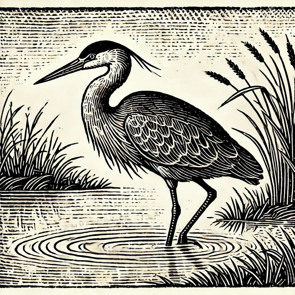
At the end of Cecil Road we reach Perry Mill Playing Field and the Forest Garden at its entrance. Hiding in the tall herbs, vegetables and flowering edibles is an egret (although, the picture above is a heron (oops)).
Near here is Holders Wood, a place local myth sometimes describes as a remnant of the Forest of Arden, but old maps tell us that this was farmland, so the trees here are secondary woodland. If you want to find Arden, though, as well as Moseley Bog, Joys Wood Nature Reserve will take you back hundreds, if not thousands, of years into the past.
This is our last stop, so we won’t be following the Rea any further. If we did, though, it trudges through Cannon Hill Park, Calthorpe Park and into Digbeth. At Digbeth, the Rea was historically used for tanning (the manufacture of leather), a process which used cow urine and turned the Rea into a stench trench! From Digbeth it flows through Duddeston and Nechells, both in the ancient parish of Aston. The mills in Stirchley paled in comparison to those here, where the air resounded with the sounds of great hammers falling, powered by the waters of the Rea. The last stretch of the Rea takes it to its confluence with the River Tame, a broad river which flows under Spaghetti Junction and Bromford Viaduct (Britain’s longest viaduct!).
Birmingham’s rivers, the Rea and the Tame, were once considered to be the most polluted in the country, and were rainbows of industrial waste. Wildlife left and plants declined. All the birds included on the trail have been seen along the River Rea in Stirchley, so it is something to be grateful for that the wildlife returns, with the help of organisations such as the Fruit & Nut Village who have, currently, been part of developing about 50 forest gardens and other sites.
Images of the paintings (apart from the robin) have not been included so that you can go searching for them…
Happy searching!
INFORMATION
Visit the Fruit & Nut Village website: www.fruitandnutvillage.org.uk
Artist, Stephen Earl Rogers: https://stephenearlrogers.co.uk/
Artist/writer, Jen Dixon: www.jennifdixon.co.uk