Stirchley is only a relatively recent addition to any map of the area. The earliest known map showing Stirchley as a distinct place is from 1814 (see below), where it’s spelt “Straitland Street”, and there was (and is) an incredibly straight piece of road which leads from the settlement of “Straitland Street” down to Breedon Cross. This road is thought, with some debate, to be a section of the Roman road of Icknield or Ryknield Street.
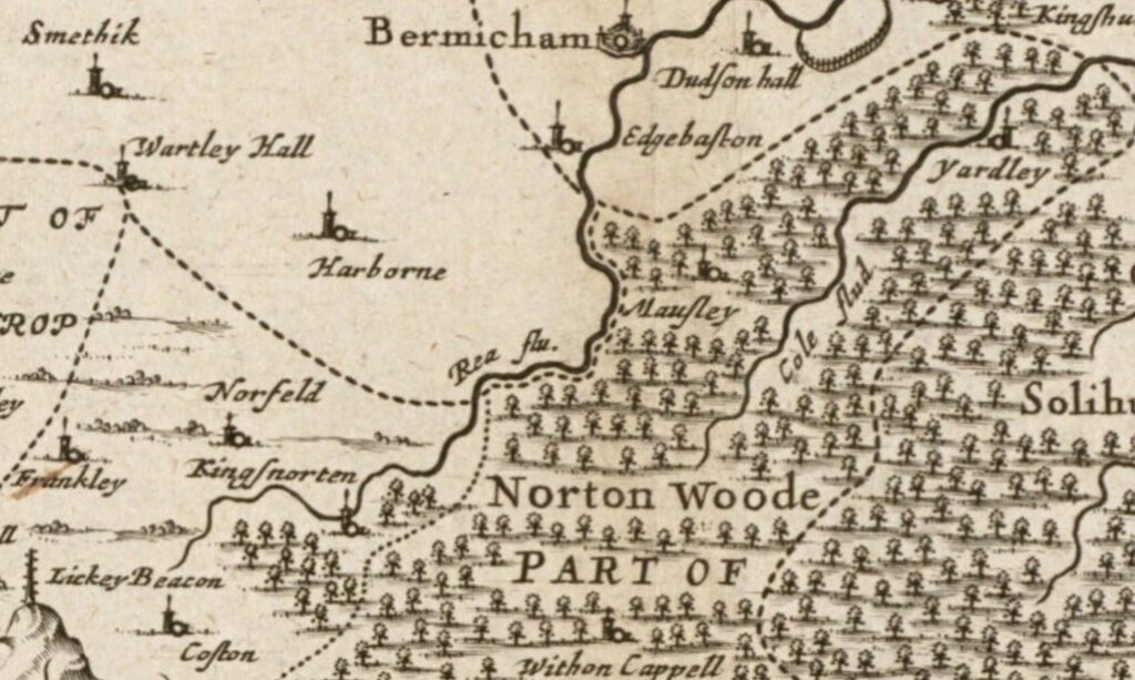
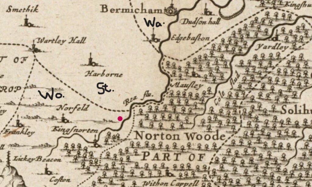
An early map of Warwickshire (map 1, above and below) from about 1646 shows the area as heavily wooded, which explains local place names such as “Yardley Wood”. Moseley is spelt “Mausley” (s’s were written a little like f’s at this time), Northfield is “Norfeld”, and Birmingham is one if its hundreds of spellings – “Bermicham”. Maps at this time were not always accurate, so it’s not 100% certain where the land Stirchley now sits on was. We know that it is east of the River Rea, and that it was south of the county border between Staffordshire and Worcestershire (the dotted line). So, I’ve estimated where Stirchley should be with a magenta dot, and marked the counties of Staffordshire (St.), Worcestershire (Wo.), and Warwickshire (Wa.) below.
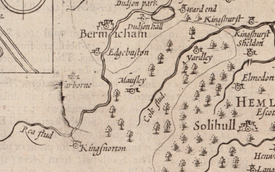
Map 2 was produced about thirty years later, in 1676, and shows the area with less woodland, and although maps weren’t always accurate, we know that this woodland was felled, because most of it no longer exists.
Although not shown on maps at this time, “Strutley Street” (an early name for Stirchley) existed from at least 1719, when it was noted in the will of a local farmer.*1*
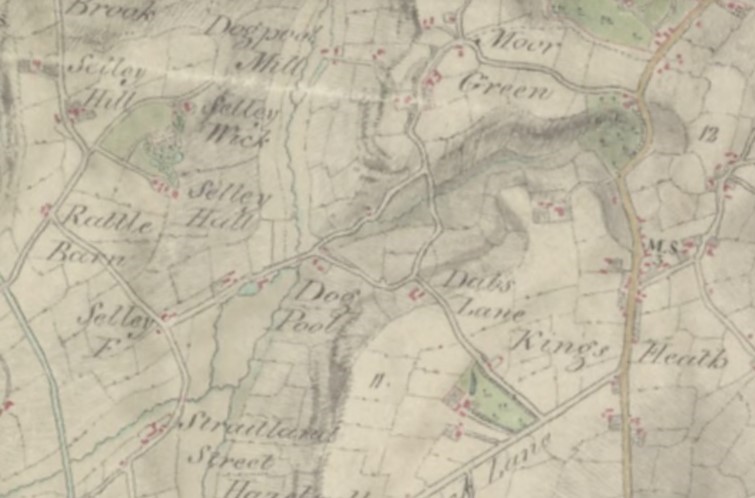
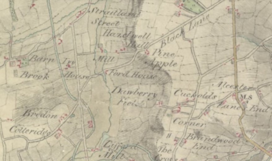
Stirchley’s first appearance on a map was on an 1814 map of Birmingham and nearby towns and villages, described as “Straitland Street”. Beyond this intriguing old name for Stirchley, there are some other interesting place names. Vicarage Road used to be called “Black Lane”, Dads Lane was “Dabs Lane”, and Raddlebarn was “Rattle Barn”. There is also “Pine Apple”, which is remembered in Pineapple Road, and a Pine Apple Farm existed there from at least the late 1600s.*2*
“Straitland Street” was an unusual spelling as in 1719, and in deeds and plans of the 1830s to the 1870s, the usual spelling was “Strutley Street”.*3* Even Stirchley School, which opened in 1863, was originally the Strutley Street Branch National School.*4* In the later Victorian period, the name shifted to “Stirchley Street”. It is unknown how the name shifted from “Strutley” to “Stirchley”, but for whatever reason, Stirchley was settled upon.
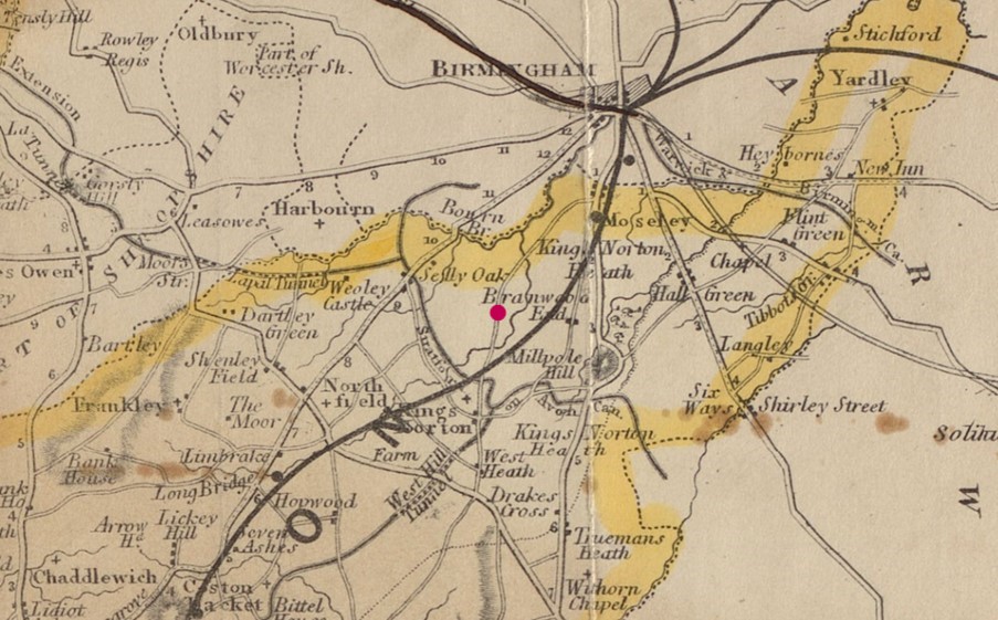
A later map, the 1863 map of Worcestershire and Gloucestershire, didn’t include Stirchley (map 4 below), but county maps only included larger settlements, and Stirchley was still small. This was only thirteen years before the opening of Stirchley Street railway station, and it was probably this that helped Stirchley grow. Stirchley Street Station was on the brand new tracks of the Birmingham West Suburban Railway, whilst the older (seen as a dark black line on map 4) Birmingham and Gloucester Railway had swept south-east of Stirchley since 1840.
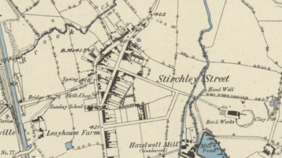
Map 5, the 1882 Ordinance Survey (below), shows the Victorian Stirchley Street settlement, shortly after the station (far left) opened in 1876. The original road route which had curved north-east had been bypassed by a new, exceptionally straight, road, which meant that a small close-knit settlement formed. This inverted “D” road formation is locally known as the gyratory. Stirchley Library and Baths were yet to be built, but their site was near the “Spring” (“416” on the OS map). Stirchley School was now twenty years old (map 5a). Brickworks and gun barrel works spotted the landscape, both important local trades.
References
*1* Probate copy of the will of William Silke of Northfield, 29 October 1719 – 4 April 1720, Birmingham Archive, MS 35/16.
*2* Abstract of Title to the Pine Apple Farm in the parish of King’s Norton. 2 May, [1678] to 26 March, 1790, Birmingham Archive, MS 3033/3/72.
*3* Deeds and plans listing Strutely Street, Birmingham Archive, 1835-1876, MS 3069/13/2/68, MS 3069/13/2/100 & MS 1466/46.
*4* Strutley Street Branch National School, [1863], Birmingham Archive, EP 107/14/1.